
Finding a Sugar Land Street Directory Trail
Start with the address exactly as it appears on the record in hand. Fort Bend County records can include Sugar Land-area parcels, but a county result still needs a check against the situs, subdivision, ZIP, court, or city information shown in that particular record. The useful trail moves from a physical parcel to a dated instrument or city file. It does not turn an address into a household roster.
For a whole block or a short street segment, narrow the task first. Decide whether the question is about a parcel boundary, a current appraisal owner display, a prior transfer, a permit, or the age of an address form. The Fort Bend County GIS map gives the spatial check that a text-only search lacks, while the recorder supplies the legal paper trail.
- Enter the street number and street name in Fort Bend CAD Property Search. Record the displayed property or geographic identifier, situs address, legal description, and selected tax year.
- Use the GIS parcel map to confirm the polygon and nearby lots. Keep the parcel identifier before changing screens because it is the strongest bridge among CAD, GIS, deeds, and city requests.
- Search the County Clerk's Real Estate Search by the street address, subdivision, lot, block, or legal description. Open the image before treating an index hit as a recorded instrument.
- Follow the legal description and instrument number through earlier and later transfers. A plat or easement may explain a road or lot without identifying an occupant.
- For construction or inspection chronology, use the City portal first, then make a focused open-records request for existing older material with the address, parcel, record type, and date interval.
Note: Preserve the exact input, source date, and separate situs and mailing labels whenever several Sugar Land records are compared.
Sugar Land Street CAD Fields
The Fort Bend Central Appraisal District Property Search is the practical first stop for a Sugar Land address-linked search. Its form offers Owner Name, Street Number, Street Name, Quick Ref ID, Geographic ID, property type, subdivision, condo, neighborhood, tax year, agent ID, DBA, abstract, mobile-home park, and hearing or board-member controls. The portal recommends simplifying a name or address when a first search is too narrow.
The public result is an appraisal record. It can show an owner display, situs, legal description, values, size, year built, exemptions, neighborhood, and the roll year. CAD says its 2026 appraisal roll is certified and warns that displayed legal descriptions and acreage should be checked for legal purposes. A displayed owner is therefore a lead to corroborate through the parcel and recorded instruments, not conclusive title or proof of present occupancy.
| CAD field | Input type | Best use in a Sugar Land street search |
|---|---|---|
| Street Number / Street Name | Optional text | Locate a specific address without assuming a person search. |
| Quick Ref ID / Geographic ID / Owner ID | Optional text | Bridge the selected parcel to later map or deed notes. |
| Subdivision / Condo / Neighborhood | Autocomplete or list | Narrow a Sugar Land street directory task by recorded area. |
| Property Type | Optional select | Separate property categories before inspecting results. |
| Tax Year | Optional select | Keep the roll year attached to every result. |
| Agent ID / Doing Business As | Optional text | Identify an entity or role field without treating it as occupancy. |
Fort Bend CAD Property Search is the source shown below. Use the address and identifier fields as a starting record, then compare the legal description with GIS and the County Clerk index.
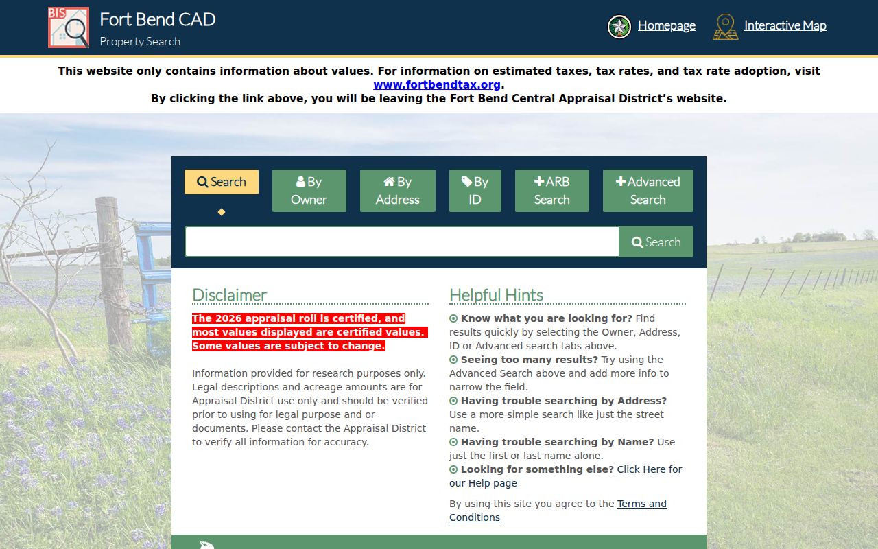
The form separates street, ID, subdivision, and tax-year controls. That separation helps keep a Sugar Land by-address search narrow and reproducible.
Sugar Land Parcel Layers by Street
Fort Bend GIS is a separate parcel source, not a copy of the CAD screen. Its public Parcel FeatureServer publishes owner-name, situs, legal, instrument, map, value, year-built, size, neighborhood, and taxing-unit attributes. The service supports query, identify, pagination and ordering options, and map export. It sets a maximum record count of 2,000, so an unfiltered return is not a complete answer for a long street.
Use the map to identify a parcel, then check the address, legal description, and parcel identifier against CAD and the recorder. GIS also carries boundaries, water districts, FEMA, schools, facilities, roads, transit, and public-safety layers. Those overlays establish geography or service context. They do not identify all people connected with an address.
- Parcel
- A mapped unit of land represented by a boundary and identifiers in CAD or GIS.
- Situs address
- The physical location attached to the parcel, which may differ from an owner's mailing address.
- Plat
- A recorded map that can show a subdivision, lot, block, road dedication, easement, or parcel change.
- Criss-cross directory
- An address-to-occupant directory format. No Sugar Land-specific run was verified in the inspected official holdings.
Note: Mark each field as CAD, GIS, or recorder-derived so a later comparison does not blur distinct sources.
Sugar Land Street Records and Coverage
A Sugar Land street directory draws on address-keyed records with different roles. CAD and GIS describe a parcel. The County Clerk records transfers and instruments. City systems can add permit or inspection chronology. The voter inquiry is not an address-search substitute, and the research did not locate a public street roster from it. Each result should retain its date, source, and role.
The County Clerk's Official Public Records include deeds, plats, mortgages, easements, assumed-name filings, powers of attorney, bills of sale, liens, and related instruments. They are indexed by parties and legal description rather than as a current-resident list. Street address, town, subdivision, lot, block, section, and freeform legal-description fields help connect a parcel to an instrument.
| Address record | Custodian | What it can show | Access route |
|---|---|---|---|
| Appraisal parcel | Fort Bend CAD | Owner display, situs, values, exemptions, legal description, size, and year built. | Public property search; current 2026 roll and research disclaimer. |
| GIS parcel | Fort Bend County GIS | Polygon, adjacent parcels, owner or situs fields, legal context, and overlays. | Public map, query, identify, and export tools. |
| Deed, plat, or instrument | Fort Bend County Clerk | Grantor, grantee, recording date, legal description, lot or block, easement, lien, or plat. | Online index and image; copy and certified-copy route through the Clerk. |
| Permit or inspection | City of Sugar Land | Permit, plan, license, or inspection chronology where displayed. | Citizen Self-Service, then City Open Records for existing older records. |
| Historical directory lead | Libraries and archives | Place-name or possible address-to-occupant evidence by publication year. | Catalog and archive route; local criss-cross coverage remains unverified. |
Fort Bend Real Estate Search is the recorded-instrument source shown below. Its View action opens an image; the screen image is not a substitute for a clean or certified copy ordered from the Clerk when one is required.
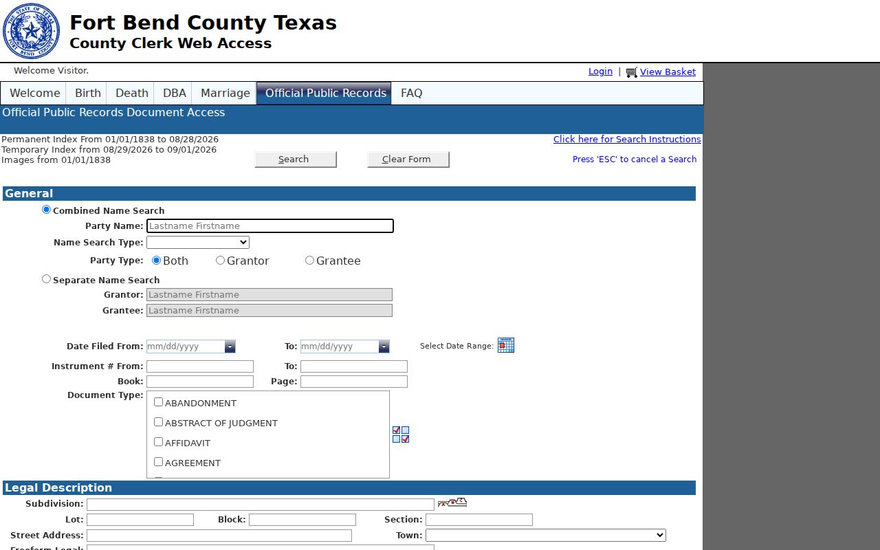
The recorder form supports party, date, instrument, book and page, subdivision, lot, block, street-address, town, and legal-description searches. A careful Sugar Land street search records the matching fields before moving to the document image.
For a needed copy, the County Clerk accepts in-person or mail requests at 301 Jackson Street in Richmond. The published fee schedule lists plain paper at $1 per page, non-certified electronic copies at $1 for the first 10 pages and $0.10 for each additional page, and certification at $5 plus page charges. Check the live schedule before payment.
For an older household question, the catalog routes and known collection gaps are described on the Sugar Land city directory collections page. A town-list result is geographic evidence, not an occupant list.
Sugar Land Street Addresses Across ZIPs
Postal labels can make a Sugar Land street directory result look inconsistent when the physical parcel is not. USPS material shows that some Sugar Land-associated labels can also appear with Stafford or Damon. Postal city names are delivery conventions, while incorporated limits and County records use other geographic systems.
The 2008 USPS bulletin moved 15,571 old 77478 Sugar Land deliveries to new 77498 Sugar Land. When an older deed, directory, or permit has 77478 and a later record has 77498, retain both original forms and record the source date. Do not call either form a typo until the parcel situs and jurisdiction have been checked.
Note: ZIP codes identify postal handling, not city limits, voting precincts, court locations, tax districts, or school boundaries.
Sugar Land Street Association Context
Sugar Land’s neighborhood registration map can add an association name to a street research note. The city describes the map and contact database as voluntary, incomplete, and not guaranteed. Named layers include First Colony Community Association, Sugar Creek Homes Association, Sugar Lakes HOA, Sugar Mill HOA, Telfair HOA, Avalon HOA, Barrington Place HOA, and Riverpark on the Brazos POA. Use the layer as a geographic lead, then confirm a parcel relationship through CAD, GIS, a plat, or dated association material.
The Texas HOA management-certificate search is a separate route with HOA name, county, city, and ZIP controls. Its Sugar Land examples are user-provided and the state warns that results are not guaranteed complete or reliable. Neither source is a membership roll. An association contact, a subdivision name, and a parcel owner are different record roles.
Sugar Land Street Result Notes
A usable Sugar Land street directory note records the source beside each field. Keep the exact address input, parcel or CAD reference, situs label, legal description, instrument number, selected tax year, and source date. If the record comes from a city portal, also record the permit or case role and the date interval searched. These details make it possible to repeat the research without treating a screen name as a conclusion.
When sources conflict, preserve both labels rather than forcing a match. A GIS polygon can be current while a deed is historical. A mailing address can differ from the physical situs. A USPS city label can differ from the incorporated city. The parcel identifier, legal description, and dated recorder image are the best tools for explaining a genuine difference.
Sugar Land Street Permits by Address
Sugar Land's Citizen Self-Service portal supports permit, license, plan activity, and inspection scheduling. Its published material does not establish a complete historical range, so an empty result does not show that no older city record exists. The portal's address formatting rule matters: the official example changes 17500 S. Grand Parkway to 17500 Grand, using the number and street name without punctuation or a suffix.
Use city permits as a property chronology, not an occupancy claim. Where the portal has no needed item, the City Open Records route can be asked for existing permit or inspection material. Include the street address, parcel identifier, permit type, department, and date interval. A broad request for everything on a street is less precise and may return large, irrelevant material.
Code records are similarly limited. Public documentation identifies violation categories, but a complete result-field schema and historic coverage were not located. Capture any released case number, address, dates, status, and resolution without extending those fields into a claim about a household.
Sugar Land Street Maps and Annexation
Historic map records can add context when a street name, parcel shape, or service setting has changed. The Texas State Library and Archives Commission catalog returned Sugar Land map entries for 1965, 1976, and 1986. The 1986 record describes streets, roads, railroads, water lines, hydrants, and stations, but the inspected search did not confirm a downloadable image. Request or review the catalog record before drawing a conclusion from it.
City limits also change the meaning of a Sugar Land address. Greatwood and New Territory were annexed in 2017, and official city material shows the population table rising from 87,730 in 2017 to 117,386 in 2018. A street associated with Sugar Land now may have sat outside the incorporated city or under a different service arrangement in an earlier source. State the record date and the geography that source actually used.
Street Directory Limits in Sugar Land
Public parcel, deed, permit, and map sources do not produce a complete list of household members or utility-account holders. A parcel owner, permit applicant, association contact, or historical name is a role tied to a particular record. It should never be presented as every person at the address. Mailing addresses can also be tax-bill or entity correspondence rather than the physical situs.
Keep the work narrow and dated. Do not use a missing search result to infer a protected address, and do not scrape or republish a street's voter information. When a record matters, verify it with the custodian and preserve only the information needed for a lawful personal purpose.
Lawful use. Sugar Land address records can support family history, property research, or civic questions. Do not use them to track, contact, harass, or intimidate a living person.