
Sugar Land ZIP Code Areas and Postal Labels
Official USPS-related material ties five ZIP designations to Sugar Land mailing labels: 77478, 77479, 77487, 77496, and 77498. Those links are useful search leads, not a map of incorporated Sugar Land. The evidence is strongest for postal facilities and the documented 2008 delivery change. It is less complete for the exact delivery type of 77487 and 77496. A careful Sugar Land ZIP code directory keeps that uncertainty visible instead of turning a label into a boundary claim.
| ZIP | Areas Covered | Post Office | Notes |
|---|---|---|---|
| 77478 | Sugar Land mailing-label evidence, with Sugar Land and Stafford combinations in USPS material. | Sugar Land Post Office, 225 Matlage Way. | The facility is listed as 77478-9998. A 77478 label does not prove an address lies within city limits. |
| 77479 | Sugar Land label and First Colony context in inspected local material. | First Colony Post Office, 3130 Grants Lake Boulevard. | The facility is listed as 77479-9998. A station address is not a neighborhood boundary. |
| 77487 | Secondary Sugar Land mailing designation in current USPS labeling material. | Facility not established in inspected sources. | USPS material also shows a Stafford combination. Exact delivery type was not located. |
| 77496 | Secondary Sugar Land and Damon labeling combination. | First Colony facility is referenced in USPS recycling material. | The recycling list identifies 77496 as a PO Box ZIP; confirm live USPS details before making a broader claim. |
| 77498 | Post-2008 Sugar Land delivery area. | Facility assignment was not established in inspected sources. | USPS documented a delivery reassignment from 77478 to 77498. |
The table is deliberately postal in scope. It does not assign an entire neighborhood to one ZIP, because the inspected sources did not provide a complete official ZIP-to-city-boundary crosswalk or a reliable neighborhood-by-ZIP population table. When the location matters, retain the original city line and source date, then check the physical situs in county GIS and the record custodian’s jurisdiction separately.
Note: Postal facilities and mailing labels should be rechecked live because delivery designations, services, and hours can change.
Sugar Land ZIP Code Directory Facilities
The two clearly identified facilities give useful anchors for a Sugar Land ZIP code directory. USPS lists the Sugar Land Post Office at 225 Matlage Way with 77478-9998, while the First Colony station is listed at 3130 Grants Lake Boulevard with 77479-9998. A facility ZIP+4 shows the facility’s mailing context. It does not establish that every nearby address shares the same postal geography or municipal status.
The state’s HOA management-certificate search provides a ZIP-capable association search surface for Sugar Land research.
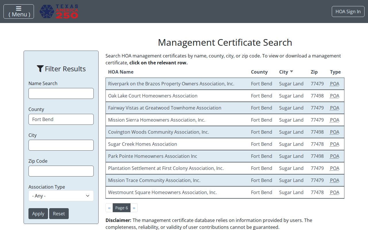
That screen can help identify an association entry by city, county, and ZIP, but it is not a household list. The state warns that management-certificate data is user-provided and not guaranteed complete or reliable. Use an association result as a lead, then compare it with a city map, parcel, and date.
First Colony is a useful example of layered geography. It appears as a recognizable community reference and as the name of the postal station, yet the station address cannot define the edges of First Colony. The city’s voluntary neighborhood map and county parcel layers answer different questions. Keeping those roles separate avoids treating a post office, an association label, and a legal parcel description as interchangeable.
Sugar Land ZIP Code Realignment
Historic address work in Sugar Land needs one special check. A 2008 USPS realignment bulletin says that 15,571 deliveries moved from the old 77478 Sugar Land designation to the new 77498 Sugar Land designation. A deed, obituary, census note, directory entry, or other older source may therefore carry 77478 while a later record points to 77498. The mismatch may be postal history, not a typo or a move.
Preserve both versions of the address. Record the source’s original city line and ZIP, then add a dated normalization note after checking USPS and the parcel location. Do not silently overwrite the old form. The number of reassigned deliveries is a useful local records quirk, but it does not say every 77478 address changed or that all 77498 addresses are in the incorporated city.
Note: A historical postal change is a comparison aid, not proof of a person’s present location or a parcel’s legal boundary.
Finding Records Through a Sugar Land ZIP Code
A Sugar Land ZIP code can narrow a candidate set, but it cannot produce a verified list of people. The inspected Fort Bend CAD form does not expose a ZIP field, and the inspected county GIS service does not publish a simple ZIP census. The Fort Bend voter request form can be scoped by county or district, not by a clearly documented ZIP-only export. Use the ZIP as a starting label, then move to an address, parcel, or legal description.
- Use USPS address or facility information to verify the mailing ZIP and keep any ZIP+4 with the original source string.
- Locate the address in Fort Bend County GIS and identify the parcel, situs, and applicable boundary layers.
- Check the situs or parcel identifier in Fort Bend CAD Property Search, using its street, subdivision, neighborhood, or geographic-ID controls rather than an undocumented ZIP filter.
- When ownership history matters, search the County Clerk recorder index by street, subdivision, lot, block, parties, or legal description, and compare the instrument to the parcel.
That workflow separates postal geography from property and jurisdiction evidence. Once a ZIP result leads to a particular street, the address-by-address method belongs on the Sugar Land streets reference. A ZIP is still worth retaining in notes because it can reconcile a postal label, a facility result, and an older document, even when it is not a searchable local resident filter.
Sugar Land ZIP Code Search Fields Compared
ZIP-capable screens do not all answer the same question. The distinction matters because a field labelled ZIP can appear to be a resident-search filter when it actually searches an association, an address, or a state-held property claim. The local tools inspected for Sugar Land offer several useful routes, but only within their stated record category.
| Source | Observed ZIP capability | Useful result | Limit |
|---|---|---|---|
| Texas HOA management certificates | ZIP field with HOA name, county, and city controls. | Association-name and management-certificate leads. | User-provided data; no complete membership roll. |
| USPS address and facility tools | Address, ZIP, and ZIP+4 verification context. | Mailing designation and facility information. | Postal labels do not establish city or parcel jurisdiction. |
| ClaimItTexas | Current ZIP field. | State-held unclaimed-property lead. | It does not search residents or prove current location. |
| Fort Bend CAD and voter routes | No ZIP control documented on the inspected CAD form or ZIP-only voter export. | Street, subdivision, parcel, county, or district research. | Do not represent either route as a ZIP-wide resident search. |
The comparison also explains why an association result should stay separate from a parcel result. A management certificate can help confirm that an organization has filed information for a named area. It cannot establish the people at each address. A CAD owner display is an appraisal record, not conclusive title or a complete household record. The recorder instrument and parcel identifiers provide the stronger bridge when the question concerns a specific property.
Sugar Land ZIP Code Boundaries and City Lines
A ZIP code is not a city limit, court boundary, tax district, voting precinct, police jurisdiction, or school-attendance boundary. Sugar Land also changed its incorporated footprint through the 2017 annexation of Greatwood and New Territory. Older records may describe a settlement, county area, postal town, or earlier municipal arrangement. Those independent systems are why a Sugar Land ZIP code directory needs the parcel and custodian checks described above.
- ZIP versus ZIP+4
- A five-digit ZIP identifies a postal delivery area. ZIP+4 adds a more specific delivery segment and should be retained when a source provides it.
- PO Box ZIP
- A ZIP used for post-office boxes can describe a mailing destination, not the physical situs of a parcel. USPS material references 77496 this way, but its wider delivery status was not confirmed.
- Unique ZIP
- A unique ZIP is assigned to one organization or destination. The inspected Sugar Land sources did not identify one, so no local claim should be made.
- Carrier route
- A carrier route is a postal delivery grouping. It can help sort mail geography but is not a municipal or legal boundary.
Sugar Land ZIP Code Labels Have Quirks
The current USPS labeling table can pair Sugar Land with Stafford or Damon in the same postal material. That is not a contradiction once the labels are treated as delivery conventions rather than as city-boundary statements. It is a useful warning for research notes, especially when two official-looking data sources show different mailing cities for a similar ZIP.
Use three separate labels in a record note: physical situs city, mailing city and ZIP, and record-custodian jurisdiction. A parcel may sit in one city, receive a familiar postal label, and fall under a county or special-district record system. The separation is especially important when reviewing old materials that predate annexation or the 2008 postal realignment.
The USPS Sugar Land Post Office listing is a useful current facility source for the Matlage Way location.
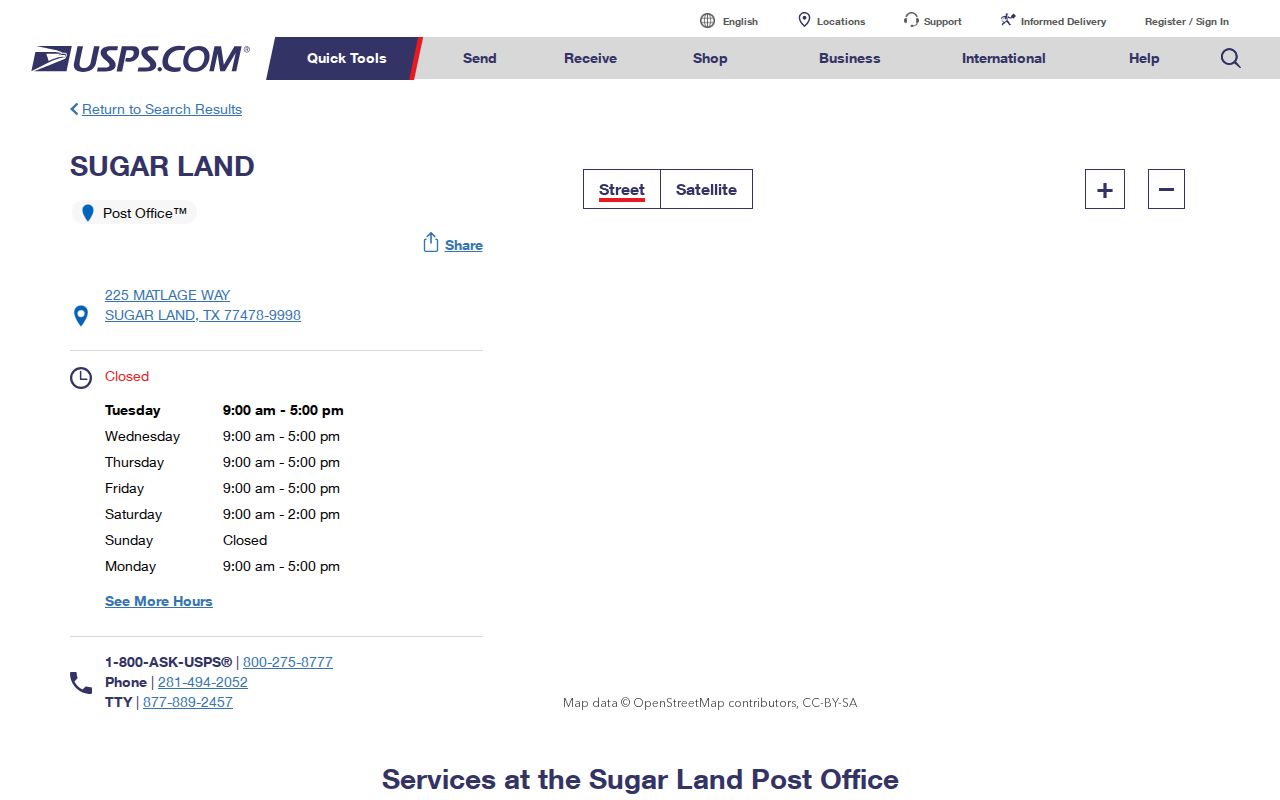
Use the facility record to verify a postal reference at the time of research, then keep it distinct from the city boundary and the parcel’s situs field.
Sugar Land ZIP Code Normalization
When the same address appears with more than one postal form, a short normalization record makes later comparison easier. It preserves the source instead of forcing every document into a modern label. This is especially helpful for the 77478 and 77498 transition, as well as for labels that reference Stafford or Damon.
- Keep the source’s original street string, city line, ZIP, and any ZIP+4.
- Record the source date and whether it is a postal facility, mailing address, physical situs, or tax correspondence address.
- Check the address in GIS, then retain the parcel identifier and the displayed situs field.
- Compare CAD and recorder fields without substituting a mailing address for the situs.
- Add a dated note if USPS material explains a historic ZIP change.
Postal evidence is strongest when it stays connected to its source and date. The final local location test remains the parcel, the city boundary layer, and the office that maintains the record at issue.
Note: Preserve uncertainty where USPS or local materials do not establish a delivery type, neighborhood boundary, or incorporated-city relationship.